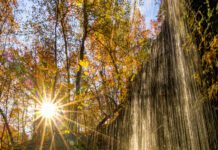
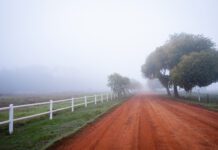
Oklahoma is wild. More than 150 years after settlers began arriving, there are still areas with landscapes that have remained virtually unchanged. Some areas are remote, isolated and difficult to explore but offer rewards of spectacular scenery and natural experience. Other areas are being restored to primal state after decades of serving as ranches. Still others are less remote but no less wild.
Glover River
The Glover is Oklahoma’s only untamed river. It flows freely for 32.6 miles in southeast Oklahoma’s McCurtain County, unfettered by dams or obstructions, through pristine forest. There are few inhabitants, no communities, convenience stores or formal campgrounds, just a few primitive camping sites.
Traveling the Glover requires training and preparation. Only experienced whitewater canoeists and kayakers with advanced skills should attempt the trek. And it requires knowledge of weather and river conditions. Sudden storms can cause dangerous flash floods.
The upper river flows through high bluffs with steep sides. The lower river is floatable most of the year and sections can even be traversed on tubes. But even here, there are whitewater rapids.
The Glover flows through private land, much of it owned by the Weyerhauser timber company. The Department of Wildlife Conservation requires a permit for these areas, $16 a year for Oklahomans, $25 for out of state with a special $5 three-day permit for non-fishing and non-hunting use.
The best times to traverse the Glover are October through May or June. The upper river is almost always too low in summer.
The Glover flows through an isolated area from the town of Battiest to a junction with the Little River at Glover. The dense woods are scenic, especially in spring.
It also offers fine fishing, especially in upper sections, which have protected pools with perch, small mouth and large mouth bass and other species.
The Glover also can be run in short sections, utilizing eight access points. But remember there are no pickup services – you have to make your own arrangements to get in and out of the river.
Charon’s Garden Mountain
Charon’s Garden Mountain isn’t much of a mountain – until you get there. Then it’s a grand and rugged 1,905-foot granite peak that offers rare beauty and great challenge to a climber.
It is in a remote 4,500-acre section of the Wichita Mountains Wildlife Refuge, which is quite a wild place itself, called Charon’s Garden Wilderness, named for a Greek mythological character.
It is not an easy area to reach. It is, says Refuge Manager Jeff Rupert, “very rugged, very remote.” One climber called it “the epitome of isolation.”
It is not much visited. Other mountains, wildlife viewing areas and attractions in the 60,000-acre Refuge are easier to reach. The 22,000-acre public use area includes 15 miles of hiking trails, plus several lakes and a number of designated climbing routes in various places. A million and a half visitors come every year. But only 550-600 venture into the Wilderness.
A commenter at www.sumitpost.org, a website for climbing enthusiasts, describes the mountain as such, “Perhaps the most appealing attribute of this mountain is its elusive nature – it truly is hardly even identifiable until you’re standing directly beneath it, and then it is monolithic, rewarding the climber for his extended approach with terrific views.” Backcountry camping permits are required at $2 per person. Only about 1,000 can be issued in any year. And there is no camping at Charon’s Garden Mountain.
Late fall to early spring is the recommended period to visit. Summer temperatures can exceed 100 degrees and winter weather can be harsh, although there will be periodic 70-degree days. The Wichita Refuge began in 1901 – six years before Oklahoma statehood – and was expanded to a game reserve in 1905 by President Theodore Roosevelt and became the Wichita Mountain Wildlife Refuge in 1935. It’s the oldest of the 550 refuges administered by the Fish and Wildlife Service.
Nickel Preserve
Tucked in Oklahoma’s famed Cookson Hills is the largest privately protected conservation area in the Ozarks region.
It is the J.T. Nickel Family Nature and Wildlife Preserve, formed by The Nature Conservancy in 2000 with a gift from John Nickel. The 17,000-acre preserve overlooks the scenic Illinois River. Spring-fed creeks meander its steep slopes and valleys, through oak and hickory forest and pine woodlands. Its diverse blend of prairie, shrubland and savanna provides habitat for many bird species.
Visitors can drive through it on a six-mile county road. There are also three hiking trails, two self-guided, which begin at Preserve headquarters six miles off Highway 10 near Eagle Bluff.
The land was assembled by Nickel, a native of Muskogee who first visited it on an agriculture field trip while a student at Connors State College.
Nickel studied architecture and was involved in a number of businesses, including a vineyard and winery in Napa, Calif., before returning to Oklahoma and a family nursery business.
In 1958, he formed Greenleaf Nursery, which became one of the largest wholesale nurseries in the country, shipping trees and plants to garden centers and landscape contractors across the country.
And he bought the land for a ranch.
But he also began talking with the Nature Conservancy about preserving it. That led to his donation.
Before the Conservancy took over, invasive and non-native grasses and plants had proliferated. It has replaced Bermuda and fescue fields with native prairie tallgrass and used prescribed burns to restore historic conditions. The result has been, the Conservancy says, “an astounding increase in botanical diversity and abundance.”
The Conservancy calls it “perhaps the last landscape-scale opportunity to address these threats” of invasive species and other threats to the ecosystem.
Among other things, the Conservancy is re-introducing elk, an animal absent from the area for half a century.
Chickasaw Recreation Area
What is now the Chickasaw National Wildlife Recreation Area was once America’s seventh national park.
It was initially designated Sulphur Springs Reservation in 1902, five years before Oklahoma statehood – and the town of Sulphur was actually relocated to make way for it. Then in 1906, it became Platt National Park and once was the most visited park in the national system.
But the character of the area changed over the years and shifted dramatically after Lake of the Arbuckles was built in 1966. In 1976, all park and recreation areas were consolidated into the Chickasaw Recreation Area.
Today, many of the springs no longer flow, and the lake is perhaps the biggest tourist draw.
With 36 miles of shoreline, 2,300 acres of crystal clear water and deep rock cliffs, Lake of the Arbuckles is one of Oklahoma’s best fishing lakes, with white bass, catfish, crappie and other species. It also is popular with divers because of its clear water. The wildlife area is also home to deer, wild turkey and game birds.
But the region has been a popular spot to visit for centuries, largely because of its water.
The first land was bought from Choctaw and Chickasaw tribes to preserve the sulphur springs believed to have medicinal properties. At one time there were 33 named springs; today only five still flow, as development and weather have changed th
But it still draws 1.2 to 1.4 million visitors a year, mainly from Oklahoma and Texas, and some families have had regular gatherings there for decades.
The original 640 acres is still part of the park and it still offers spectacular wooded hills in what is not a remote area.
Cooper Wildlife Area
In far western Oklahoma on nearly 17,000 acres of rolling sand hills and river bottomland is the Hal and Fern Cooper Wildlife Management Area, which fronts four miles of Highway 3-183.
It’s the kind of land Western movies often depict and many people think of when they hear Oklahoma. It is grass prairie and sagebrush and sand plum thickets. The 5,400 acres of bottomland has cottonwood, American elm, hackberry and eastern red cedar trees intermixed with grassland, salt cedar and sand plum.
The area is where the Canadian River begins, formed by the union of Wolf Creek and the Beaver River.
Hal Cooper ranched there for decades. After his death, his widow Fern arranged to transfer the land to the state for the wildlife area in 1992. It’s one of Oklahoma’s best quail-hunting regions but also has fair numbers of wild turkeys and other wildlife.
The area is northwest of Woodward, adjacent to the Fort Supply Reservoir.
It’s fairly dry – about 20 inches of rain per year. The sandy bottomlands have bluestem grasses, sagebrush and sand grasses. Dunes have thickets of sand plum. Some trees grow along the river, mostly elm, black willow, soapberry and cottonwood, with some hackberry.
The area is managed for wildlife, although some cattle run through grazing leases in the summer. Windmills and solar pumps provide water for wildlife and a few areas are planted with ragweed, croton and sunflower to provide wildlife food.
Fort Supply draws the most visitors. Most of Cooper’s visitors are hunters, mainly in the fall, seeking quail and dove.


