


Oklahoma does not fit into a neat regional category. It’s not quite the west, and it isn’t the south. Oklahoma stands on its own. The state’s location, however, means that its biodiversity is unparalleled, and this bodes well for hikers.
“One of the best aspects of hiking in Oklahoma is the diversity of its terrain,” says Kent Frates, co-author of the book Oklahoma Hiking Trails. “Oklahoma has everything from a high desert setting, like in Black Mesa State Park, to rocky plains in the Wichita Wildlife Refuge, to rugged, dense piney woods in the southeastern part of the state. It’s also possible to hike in Oklahoma year round.”
Oklahoma’s best hikes are scattered all over the state, and many can be found in state parks.
High Point Trail
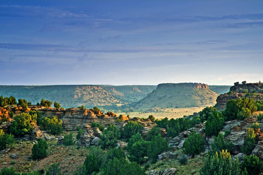
Black Mesa State Park
A lot of Oklahoma is very flat, but on the High Point Trail at Black Mesa State Park, hikers can reach the state’s highest point: 4,973 feet above sea level.
Black Mesa State Park is located on the very tip of the panhandle, barely within Oklahoma’s state boundary. West Regional Park Manager Bruce Divis says the summit point on High Point Trail is what often brings visitors.
“The landscape and vistas are like no other in Oklahoma,” Divis says of the High Point Trail. “And people like to say that they have hiked to the highest point in Oklahoma. A granite obelisk monument marks the spot, and the views from the mesa look into Oklahoma, Colorado and New Mexico.”
Divis estimates the trail’s level of difficulty to ranges between medium and difficult. The High Point Trail is nearly eight miles round-trip to the end and back and can take an estimated four or five hours at a leisurely pace.
“The first two miles are on relatively gentle, sloping terrain, and then the trail ascends for about three-quarters of a mile. Then there is one mile on level ground to the high point summit,” Divis says.
But the hike isn’t just about the summit; Divis says the trail’s interesting terrain makes this one of the best Oklahoma hikes.
“The Black Mesa area is where the Rocky Mountains meet the short grass prairie. It is unique in that it represents an area where many species are at the easternmost or westernmost portions of their range,” Divis says.
No matter what time of year, this area is “a birder’s paradise,” Divis says.
Larry Floyd, co-author of the book Oklahoma Hiking Trails, says the High Summit Trail is one of his favorites.
“For me, Black Mesa is Oklahoma’s gateway to the west. So this trail is high in ‘exotic factor,’” Floyd says.
He recommends visiting this state park in the winter during the “snake-free” months; he says copperheads and rattlesnakes can be real concerns in the spring and early fall.
The High Point Trail is located on the nature preserve portion of Black Mesa State Park, about 12 miles from the camping area. Kenton is the closest town, about five miles away, but has no gas or food; but Boise City, 35 miles away, offers amenities.
Photos courtesy Oklahoma Department of Tourism & Recreation.
Dripping Springs Trail
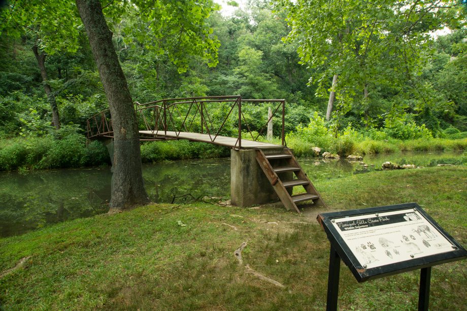
Natural Falls State Park
The Dripping Springs Trail, located in the northeast corner of the state, is one that lives up to its name. Tracey Robertson, Natural Falls State Park manager, says this trail is by far the most popular at Natural Falls State Park.
“The first portion of the trail takes you to the overlook at the top of the 77-foot Ozarks springs. For those that would like to, they can travel down the 47 steps to the base of the falls. This area includes an elevated boardwalk to help protect our natural resource,” Robertson says.
The trail entrance to the overlook is ADA-accessible, but the remaining part ranges from moderate to difficult. The total length of the trail is a half-mile and takes an estimated 45 minutes, Robertson says, but hikers can also choose to either make the loop and walk back or access one of the park’s other four trails.
This trail has been a visitor destination for nearly 100 years.
“Dripping Springs has been a tourism attraction since the early 1920s. As local folklore goes, the falls area was an encampment to Native American tribes before the Trail of Tears and also, both the Union and Confederate soldiers during the Civil War,” Robertson says.
The waterfall definitely draws people to this area, Robertson says, but a family of freshwater river otters can also occasionally be spotted.
“The most common thing we hear from first-time visitors is, ‘We never knew something so beautiful existed here,’” Robertson says.
Ferns, mosses, liverworts and other native plant species can be found along the Dripping Springs Trail.
Skyline Trail
Beavers Bend State Park
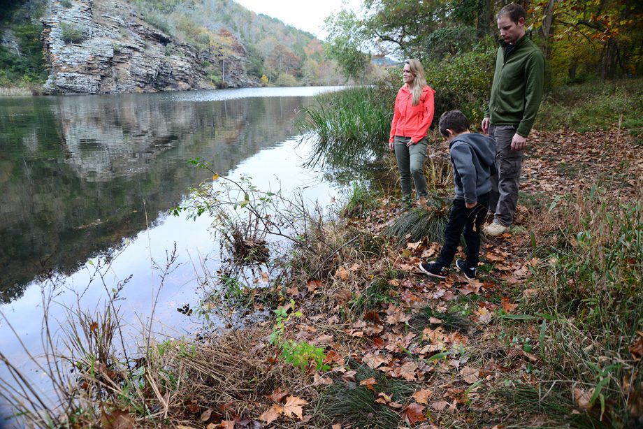
Imagine starting a hike above a river, transitioning into a walk among rolling hills, crossing a creek several times, following switchbacks to get to a waterfall, passing old logging roads and traipsing through the woods, and you’ve imagined the Skyline Trail.
The Skyline is part of the David Boren trail system at Beavers Bend State Park. The series of trails is seven miles long, with the Skyline portion consisting of four miles.
“It’s fairly rough terrain with some areas that are pretty steep, so we recommend it for serious hikers,” says Beavers Bend Naturalist Frank Griffith. “The time the trail takes always depends on the hiker, but I tell people to estimate about one mile per hour to allow time to take in the scenery and take pictures.”
A camera might come in handy for many sections of the Skyline.
“There is some great scenery all along the trail and always something to look at,” Griffith says.
Hikers can find lots of deer, rabbits and squirrels, with the occasional turkey as well, Griffith says, and bald eagles can be spotted at certain times of the year, generally from winter to early spring.
“But that’s just to name a few things you can find,” Griffith says. “Visitors always love the waterfall on this trail.”
Beavers Bend is located in McCurtain County in the southeast corner of the state, close to the Texas and Arkansas borders, in the Kiamichi wilderness area. The Kiamichi Range is part of the larger Ouachita Mountains.
North Woods Trail
Oxley Nature Center
Located on the northern edge of Tulsa’s city limits, Oxley Nature Center is a popular source of escape from city life for residents and other visitors.
“Thousands of people come here every year, but it’s easy to go in and not see another human being. It makes you feel like you’re way out in the wilderness,” says Oxley Nature Center Director Eddie Reese.
Reese says although it’s hard to choose, the North Woods Trail is one of the best at the nature center. North Woods is a one-mile loop with a half-mile trail that leads to the trailhead.
“You can see some extra-large trees on this trail and lots of deer. And some of the plants to look out for are green dragons (those can be found in large numbers), lily pads on the water and plenty of wildflowers,” Reese says.
Hikers walk along a lake, through hardwood trees and along several creeks on the North Woods, experiencing different habitat types along the way.
“You go through prairie, woodlands and wetlands in this area,” Reese says. “Basically any type of terrain in northeast Oklahoma you can find, it’s here.”
Those paying close attention might be able to spot ospreys or nesting eagles, Reese says.
Most of the trails at Oxley Nature Center, including the North Woods Trail, are shorter and loop together, ranging in length from a third of a mile to one mile. The land was set aside as a wildlife area in the 1970s.
Greenleaf Lake Hiking Trail
Greenleaf State Park
For those seeking a “real wilderness experience,” says Greenleaf State Park Naturalist Steve Evans, the Greenleaf Lake Hiking Trail provides an opportunity that should not be missed. This hiking and mountain bike trail wanders through part of the oak and hickory forest of the Ozarks in eastern Oklahoma.
“The trail is about 19 miles long, and the average hiker should allow at least 13 hours to hike the whole trail. There are two primitive campsites along the trail, and most visitors that want to hike the whole trail take backpacking equipment and spend the night on the trail, making it a two-day hike,” Evans says.
The trail consists of two large loops, the South Loop (eight miles) and the North Loop (six miles). To reach this area from the park, hikers first travel about two-and-a-half miles to arrive at a suspension bridge that marks the beginning of the South Loop portion. Evans advises caution on sections of the North Loop because some areas are currently overgrown.
The Greenleaf Lake Hiking Trail is classified as between medium and difficult. Most of the hike is fairly level, with some steep areas through the Ozark Uplift hills, Evans says, and the trail passes over and through some boulder-covered areas in the North Loop.
“Anyone in fairly good shape can hike it, but it is a reasonable challenge to most people. Be prepared to hike a real trail; it is not a city park,” Evans says.
He adds that on a busy day in the summer, there may be 50 or so hikers on the trail.
The park also offers a Family Fun Trail that is paved and ADA-accessible.
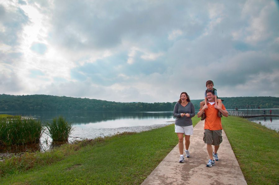
Photo courtesy Oklahoma Department of Tourism and Recreation.
Inspiration Point Trail
Roman Nose State Park
Roman Nose State Park Ranger Jerret Sanders says the park’s Inspiration Point Trail gets its name from its viewpoints.
“You can see the entire canyon from the point, and it has spectacular views of the surrounding areas,” Sanders says. “It also gives our guests the chance to use their imaginations to picture what it all looked like back when the Cheyenne and Arapaho tribes made this their winter camp. It’s a great place to go and reflect on the many changes that the land has seen through the years as it changed from a grassland to a park built for people’s enjoyment.”
Inspiration Point is part of a trail system at Roman Nose, so visitors have the option of creating their own customized hikes, but this trail itself is a round-trip of about three miles and is estimated as moderate to difficult. Sanders says the trail would take about two hours depending on the size of the hiking group.
“The trail winds along the side of the canyon and has very different terrain throughout the hike. We have really good trails, but there are some pretty steep inclines and declines along the way,” Sanders says.
The trailhead for Inspiration Point Trail is located near the Lake Watonga parking lot. In addition to the view, this hike is unique due to the gypsum outcroppings, white in color, that hikers scale throughout the hike.
Watonga, located about seven miles from the park, is the closest town to Roman Nose. The park is named after Cheyenne Chief Henry Roman Nose, who lived in the canyon area for several decades before he died in 1917. Roman Nose State Park is one of Oklahoma’s original seven state parks established in 1937 by the Civilian Conservation Corps.
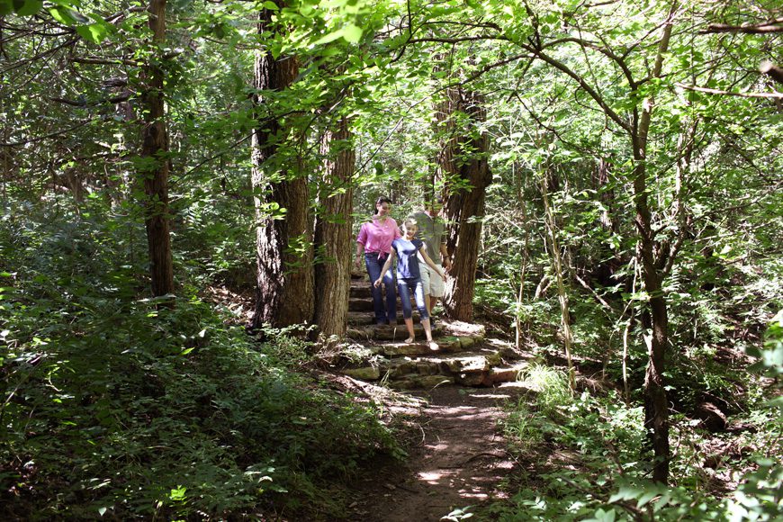
Photo courtesy Oklahoma department of Tourism and Recreation.