More on OKC’s Destination Markers
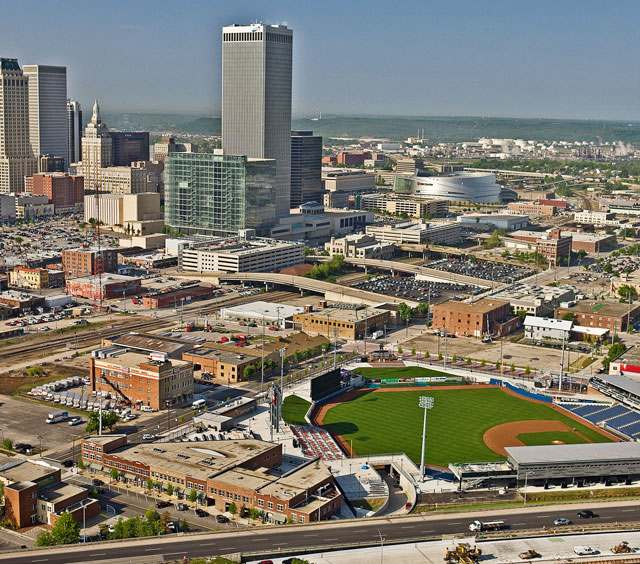
As part of the Project 180 streetscape renovations, Oklahoma City installed a series of destination markers throughout downtown. The destination markers depict an aerial map with a small silver pin that denotes showing the marker’s location on a map. The outer ring of each destination marker highlights a local historic or pop culture event specific to the city. There is a walking tour of the markers available through Museum Without Walls. There are 25 markers installed in OKC’s downtown area. Here are the locations and facts located on each marker.
1. West side of Patience Latting Circle
• Patience Latting Circle honors the first woman to be elected mayor of a major American city. Serving three terms from 1971 to 1983, she was highly respected for her integrity and dedication to the city and its citizens.
2. West entrance into the Art Museum
• The Oklahoma City Museum of Art, opened 2002, utilizes the façade and theater of the 1947 Centre Theater in an expanded building housing three floors of galleries for exhibits and collections, including the works of Dale Chihuly, whose glass towers are featured in both lobbies.
3. East side of Walker between Colcord and Couch
• The Municipal Building, the seat of Oklahoma City’s government, was erected in 1935-36 on a site once occupied by a territorial home and later a railway depot. At the time it was built, the city was 25 square miles in area with a population of under 200,000.
4. South side of Couch between Walker and the drive in front of the Civic Center
• Couch Drive honors William L. Couch a leader in the Boomer Movement to open the Unassigned Lands to settlement and first provisional mayor of Oklahoma City, elected April 26, 1889. Couch was shot by a disgruntled land claimant and died of his wound in April 1890.
5. North side of Colcord between Walker and the drive in front of the Civic Center
• The Civic Center Music Hall, built in 1937 as a multi-use facility seating over 6,000, hosted circuses, basketball and midget car races as well as conventions and performances. It has been twice remodeled to provide a sloped floor and concert seating, creating a premier performing arts venue.
6. North side of Main between Lee and Dewey
• Three blocks to the west, the Ford Assembly Plant was opened in 1915 by Henry Ford, who pioneered the mass production of cars. Employing 250 workers at its peak, it was reorganized as a regional parts depot during the Great Depression and operated until 1967.
7. South side of Main between Walker and Hudson
• In the two blocks to the east, John A. Brown’s, Kerrs, Street’s, Haliburton’s, Rothchild’s, Kress, J.C. Penney, Sears and B.C. Clark were part of a thriving downtown shopping district from the 1920s until the 1960s, when the buildings were demolished to provide room for a new downtown.
8. North side of Sheridan between Walker and Hudson
• “Horse Show Capital of the World.” Oklahoma City’s State Fair Park at NW 10th and May hosts more horse shows each year than any other city in the world, including over a dozen national and international championships.
9. East side of Walker between Reno and California
• Old Central Fire Station. Constructed after World War II, this complex was the City’s #1 Fire Station until 1967. In 1982 it was leased to the Arts Council to serve various arts groups. California Avenue was closed in 1985 to create the Festival Plaza for the annual Festival of the Arts.
10. South side of Reno between Walker and Hudson
• Reno Avenue recognizes Ft. Reno, located 30 miles to the west. Founded in 1875, it housed units of the famed “Buffalo Soldiers”, the Black soldiers of the 9th and 10th Cavalry and the 24th and 25th Infantry, who helped maintain the peace before and after the Land Run.
11. West side of Hudson between Sheridan and Reno
• Stage Center. Architect John Johansen received an American Institute of Architects Honor Award for this unique theater complex completed in 1970 as the home of Mummers Theater Company. Purchased by the Arts Council of Oklahoma City in 1986, it houses performance and visual arts programs.
12. North side of Reno between Hudson and Robinson
• Stockyards City, two miles to the southwest, founded in 1910, was a center for meat packing and cattle sales. The packing plants closed in 1961. The Oklahoma National Stockyards Company remains as one of the Nation’s major cattle markets. The area is a center for western apparel and goods.
13. South side of Reno between Hudson and Robinson
• Four miles to the southeast, Tinker Air Force Base was built in 1941 to repair and modify bombers and cargo planes as the nation prepared for World War II. It has continued its mission of support for our Nation’s aircraft in every major conflict and is the state’s largest employer.
14. North side of Reno between Robinson and Gaylord
• Oil or “Black Gold” brought new wealth in 1928 with a discovery well located about six miles southeast of this site. By 1935, 1,713 wells had been drilled as the oil field reached beyond NE 23rd Street and included working wells on the State Capitol grounds, some of which remain today.
15. South side of Reno between Robinson and Gaylord
• “Oklahoma, the Sooner State.” “Boomer” and “Sooner” are terms from the Land Run of 1889. The Boomers were those who worked to open the Unassigned Lands of Oklahoma for settlement. The Sooners were those who entered illegally to stake claims before noon on April 22, 1889.
16. South side of Sheridan between Broadway and Gaylord
• Opened as the Myriad Convention Center in 1972, this was the first public building completed under the Pei Plan for rebuilding the central city. The building has welcomed Presidents George H.W. Bush and Bill Clinton as well as the Rev. Billy Graham, Elvis Presley and the Rolling Stones.
17. East side of Robinson between Sheridan and Reno
• Red Earth Festival, a major Native American cultural and arts exposition, was founded in 1987. The opening parade has filled streets with participants in full regalia. More than 1,200 Native American artists, dancers and singers from over 100 tribes have gathered each June for the festival.
18. East side of Robinson between Sheridan and Reno
• “By our own Bootstraps.” In 1993, citizens voted a special tax for nine Metropolitan Area Projects (MAPS) including a downtown arena, the Bricktown Ball Park and Canal, a new library and the Oklahoma River. The resulting $3 billion in public-private investments changed the face of the city.
19. West side of Robinson between Park and Sheridan
The Colcord Building, one of the city’s first skyscrapers, was built in 1909 – 1910 by Charles Colcord. Constructed after the great San Francisco earthquake of 1905, it was built to withstand earthquakes and fire. Built as an office building, it was remodeled as a hotel in 2006.
20. West side of Robinson between Park and Sheridan
West of this site on April 19, 1958, Clara Luper led 13 African-American youths in the nation’s first lunch-counter sit-in at Katz Drugstore. After sitting quietly amid jeers and abuse, they were removed by lawmen. “Sit-ins” spread across the nation, helping bring an end to segregation.
21. West side of Robinson between Park and Sheridan
Constructed in 1920 on the site of both the city’s first open-air theater and Lyric Theater, the Perrine /Cravens/Robinson Renaissance Building was once home of the popular Anna Maude’s Cafeteria.
22. North side of McGee between Harvey and Robinson
• Old Post Office Building. It cost two cents to mail a letter when the east wing of the new Post Office was constructed in 1910. The west wing and central tower were added in the 1930’s. Its long rows of service windows attest to a period when everything was sent by mail.
23. West side of Harvey between NW 4th and NW 5th
• St. Joseph Catholic Church stands on the site of a wooden church constructed in 1889. The present building opened in 1904 and became the first
24. West side of Robinson between NW 4th and NW 6th
• A portion of the back wall is all that remains of the Alfred P. Murrah Federal Building destroyed by a bomb on April 19, 1995, killing 168, wounding over 650 and destroying or damaging buildings throughout downtown. The Oklahoma City National Memorial now takes its place.
25. West side of Robinson between NW 4th and NW 6th
• Constructed in 1923 as the Masonic Shrine Temple and Theatre, this building hosted the state premier of the movie “Oklahoma!” and was later home to the Journal Record Company. Heavily damaged in the 1995 Murrah Bombing, it now serves as the Oklahoma City National Memorial Museum.


