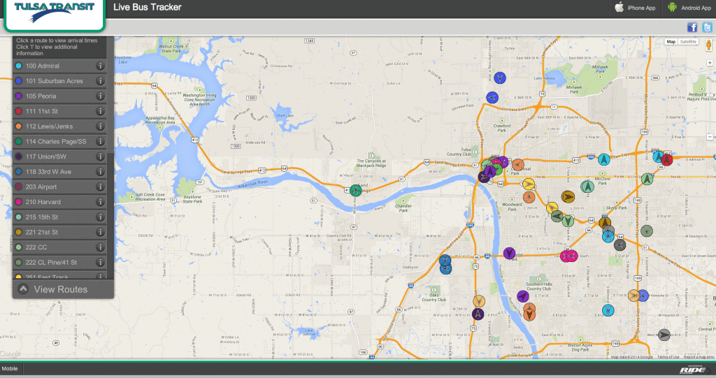
For those who have ridden the city bus, it’s a common ritual: Standing at a bus stop, checking your watch, peering down the street hoping you’ll see your bus round the corner or crest that hill. In 2013, Tulsa Transit unveiled its Bus Tracker program to take a lot of the guesswork out of using public transit.
Bus Tracker is a program available on computer, smartphone or tablet. Tulsa Transit partnered with Ride Systems to implement the program. Every Tulsa Transit bus is fitted with a GPS tracker that relays that bus’ position and direction to an online map that is updated in real time. Riders can go to www.tulsatransit.org and click on Bus Tracker to see the map with each bus’s position on every route in Tulsa.
There is also a Ride Systems app available at smartphone app stores that delivers real-time updates.
So far the system has been a great success for Tulsa Transit and its riders.
“I’ve personally been out for events, and people tell me they love it,” says Liann Alfaro, planning manager at Tulsa Transit. “Especially if it’s cold or rainy, they know when they need to get to the bus stop to be able to catch the bus.”
Tulsa Transit also released an online trip-planning program that allows riders to plan their journeys on a map with personal schedules; Tulsa Transit has also put its route schedules into Google Transit, allowing users a multitude of ways to plan their journeys around Tulsa.


